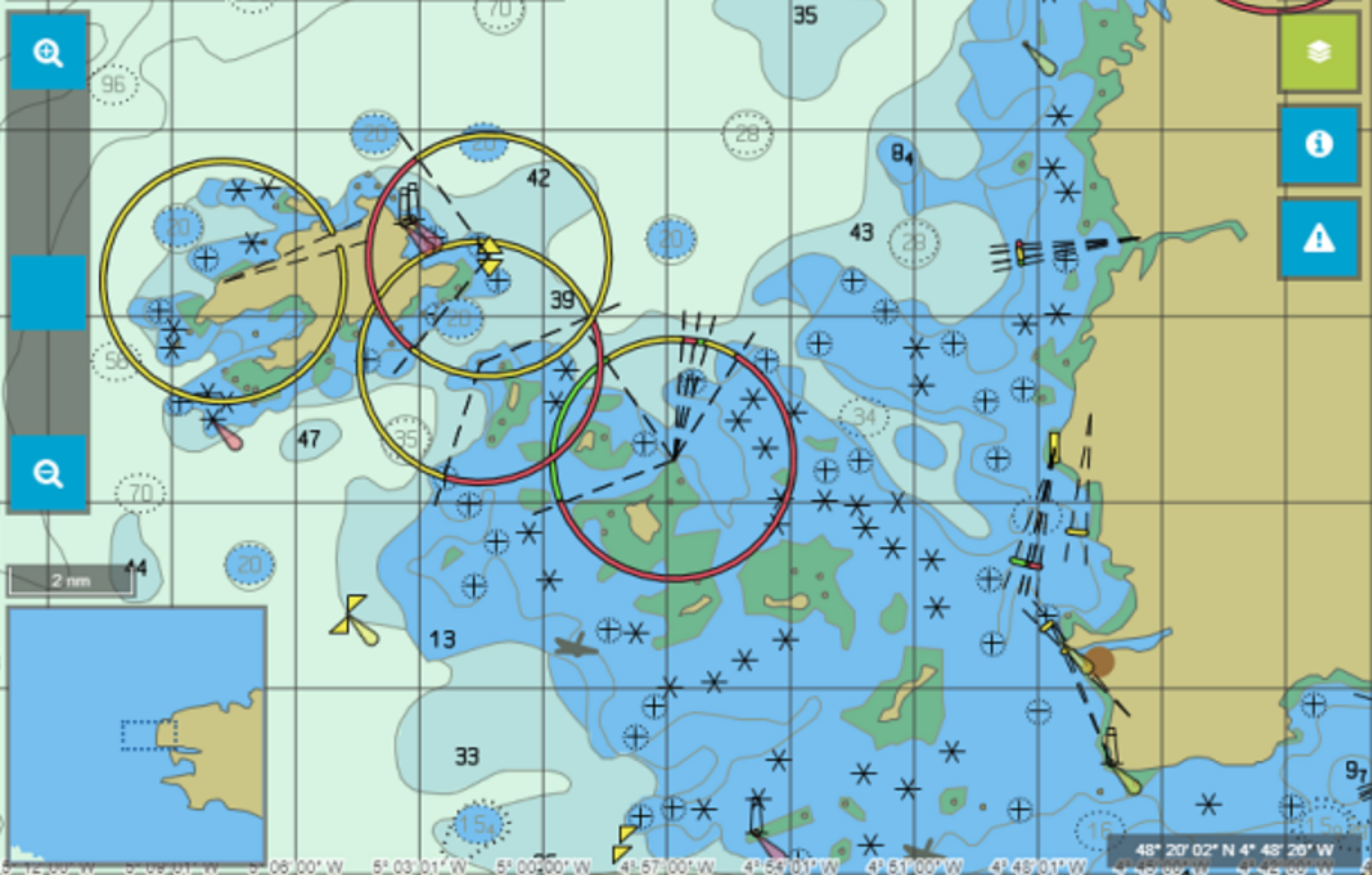
The Marine WMS web server for operating S57 data
WMS Marine is a web server offering WMS (Web Map Services) query capabilities for displaying ENC data.
This server allows you to display cartographic information from Electronic Navigation Charts (ENC) in your web browser in the form of georeferenced S52 standard images (GetMap) and image queries (GetFeatureInfo).

Operation and display of electronic navigation charts - ENC
WMS Marine's flexibility is a real innovation on the world market. It makes the most of ENC vector data to produce a high-quality image. The possibilities for interrogating objects fully exploit the capabilities of the WMS protocol. This product is not authorised for navigation, but it is perfectly suited to the surveillance of ports, platforms and coastal management, based on a flexible architecture with data shared by users.

The marine WMS benefits
WMS Marine is composed of a Tomcat web server, a GeoWebCache image cache manager, and is based on our KarMor SDK for image creation. It can be used on Windows (including through IIS) as well as Linux. Any standard WMS client can use the server.
WMS Marine's display performance is particularly remarkable compared with what is usually available, and Geomod has also treated this aspect with extreme precision.
The server's map database can be filled with unencrypted (S57) or encrypted (S63) ENCs, IENCs, bENCs or AMLs. You can update your map data in the same way as your business data.
The symbolism of the objects is the official IHO symbolisation (S52) implemented in the navigation systems by default. However, the system can be configured to allow you to define your own symbols to suit your requirements.
The information contained in the ENCs is returned to the client in the form of thematic layers. These layers can be configured. For example, it is possible to create a "Regulations" layer containing all the objects in the ENC concerned by this theme. The selection of objects for a layer can be fine-tuned. It is therefore possible to distribute instances of objects of the same type in different layers using filters based not only on the type of object but also on the characteristics (attributes) of the object, for example:
- Differentiate restricted areas associated with navigation from restricted areas associated with administration.
- Differentiate between historical wrecks and wrecks in general.
Geomod integrates your own business data layers into the WMS server through on-demand developments. On the other hand, the technologies used can be integrated into your existing web services.s.
WMS Marine is delivered "turnkey": Geomod supports you in the delivery, installation, integration and cartographic configuration of this server.
As a software solutions developer, Geomod is able to respond to all your needs concerning functionalities using ENCs (filtering, queries, etc.).