MariNAV, cartographic management of marinas
Optimise your mooring space with a web application developed by the GEOMOD teams.
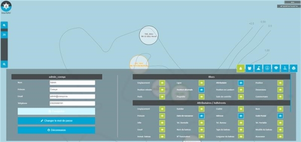
4 modules to view the most up-to-date status of your marina and share information in real time with other managers.
MariNAV is easy to use and allows you to
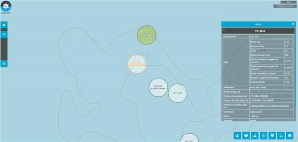
- Listing of all mooring lines. Customised characteristics to suit your needs (water height, number, dead chain, rising chain, size of boat possible, etc.).
- Mooring zone referencing. Customised features to suit your needs (owner, attribute, position, size and weight)
- Attribute management (detailed database containing boat coordinates and characteristics)
- Monitoring of the condition of blocks and the need for re-checking
- Print the mooring plan and export data (Excel table)
Easy to use, our teams will help you get to grips with the tool with dedicated training.
For more information: lucile.lallie@geomod.fr