MithraREM, the reference tool for simulating exposure to electromagnetic fields
Electromagnetic radiation: how do you model and map wave propagation?
With the rise of new technologies and the digital transition, electromagnetic fields are increasingly present in the daily lives of French people. However, despite the growing number of antennas and frequency bands, the average level of exposure of the population remains stable overall. This is a complex subject that requires effective, educational tools.
Electromagnetic wave mapping software
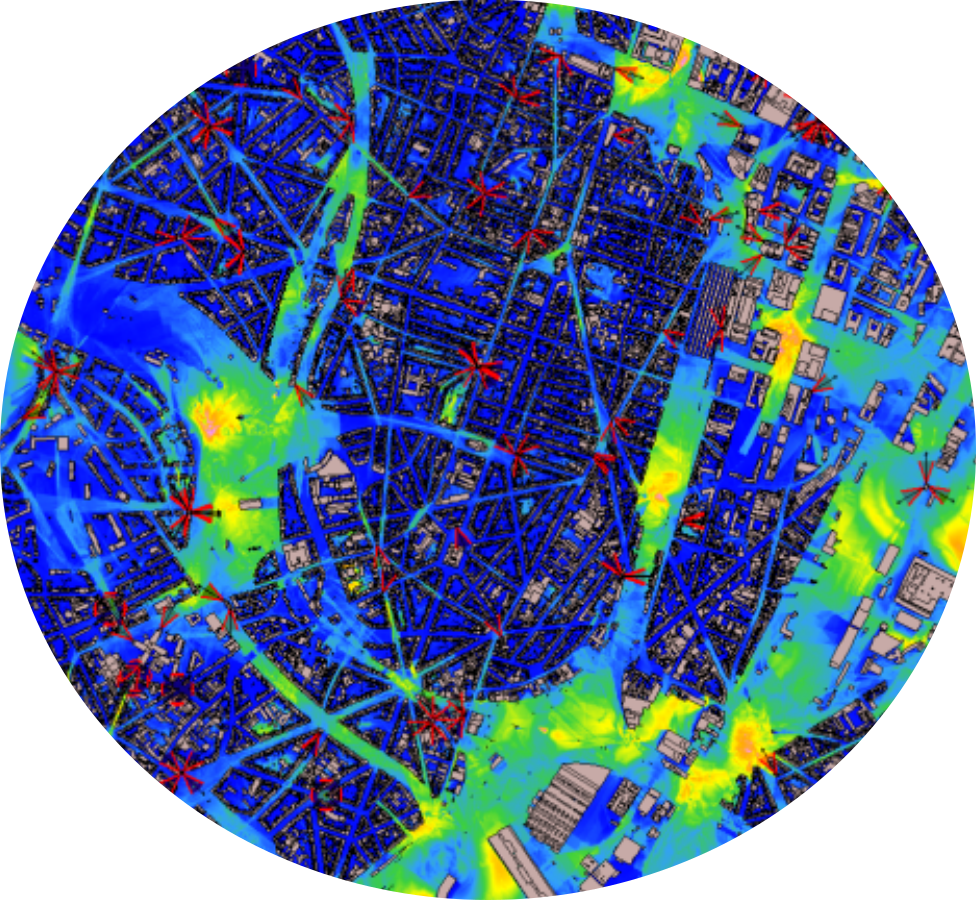
MithraREM has been the leading software for simulating exposure to electromagnetic waves for over 10 years. Renowned for the quality of its simulations, it calculates the propagation of waves and the radiation from transmitters on a city-wide scale.
MithraREM stands out for its intuitive use, the performance of its calculations, the dynamic display of its results, its input/output communication capability and the quality of the documents produced.

A solution for measuring electromagnetic fields resulting from the collaboration of two experts
MithraREM is the result of collaboration between 2 specialists in their field:
The CSTB (Scientific and Technical Center for Building), which for 30 years has been developing calculation methods to model all the physical phenomena linked to the propagation of electromagnetic waves.
In parallel, the CSTB also carries out measurements of electromagnetic fields in the laboratory and in situ.
Geomod, an expert in geomatics, recognised for its high responsiveness in development and the quality of its user support, provides its expertise to development and integration.

A comprehensive tool for modelling and simulating exposure to electromagnetic waves
MithraREM can manage frequencies between 30 MHz and 26 GHz, including
therefore:
- Radio and television (digital and analogue)
- 2G, 3G, 4G, 5G mobile telephony (GSM, UMTS, LTE, NR)
- Wi-fi
MithraREM can be used to calculate the impact caused by:
- Adding antennas
- Modifying an existing site: new technology, change in power, change in electrical tilt, change in antenna model, etc.
Create your model quickly and easily using simple, intuitive interfaces.
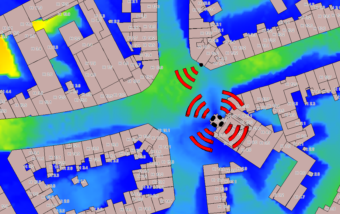
- Convert your data in just a few clicks from a simple 2D extruded building model to a 3D model with roofs.
- Automatically create your models from SRTM and OpenStreetMap data.
MithraREM Convert your data in just a few clicks from a simple 2D extruded building model to a 3D model with roofs. • Automatically create your models from SRTM and OpenStreetMap data.
MithraREM is the most accurate and powerful software dedicated to calculating exposure to electromagnetic fields.
MithraREM uses algorithms based on beam launching. A geometric engine determines all the 3D contributions of the antennas, and a physical engine calculates these contributions for each frequency band and each antenna, taking account of the materials encountered.
MithraREM can calculate the electric field level in V/m (or V/m 900 equivalent), the magnetic field in A/m, the power density in W/m², and the emission % in relation to international regulations (ICNIRP).
The rendering settings are dynamic. It is possible to 'switch off' or 'switch on' antennas, emission systems and frequencies. The display is updated in real time.
The contribution analysis tool provides one-click details of contributions by antenna, operator, frequency and technology for each calculation point.
Calculate anywhere
MithraREM can be adapted to several types of project, from the calculation of a precise zone around a future antenna to a city-wide overview

Various types of calculations can be carried out:
- Horizontal sections (ground map)
- Vertical sections
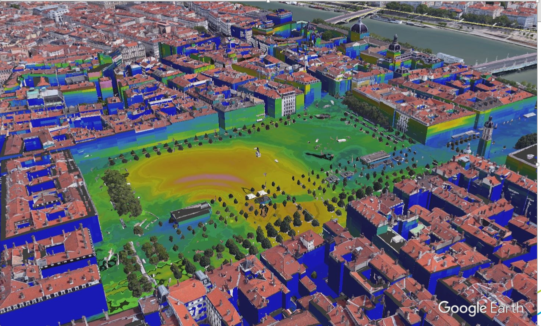
- Facade/building envelope maps (exterior or interior)
- Terrace maps (above buildings)
- Indoor horizontal sections in buildings, taking account of facade attenuation (ANFR guidelines)
- Tables of values for specific points
It's easy to update results as the network changes, as no in-situ measurements are required. Just import the new antennas and run the calculations again.
An essential tool for dissemination and communication
By measuring exposure to electromagnetic fields from existing or future antennas, MithraREM provides information on the populations affected.
MithraREM incorporates a powerful and intuitive reporting tool that allows you to format the maps before publishing them.
- Export in KMZ (compressed KML) for visualisation with Google Earth™ or virtual model.
- Export to PDF, organised into layers and allowing objects to be queried.
- Export to SHP, DXF, DWG, GeoJSon, etc.
- CSV export (Excel-compatible file) in table form for total field strength, the most significant antennas, frequencies, technologies, contributing operators, calculation point height, X-Y-Z position, etc.
